- Login
Thomas Bowles (British, 1712 - ?)
Item 1 of 1
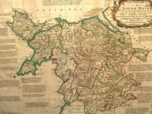
| An Accurate Map of North Wales divided into its Counties, Viz, Carnarvonshire, Flintshire, Merionythshire, etc.. | |
| Thomas Bowles (British, 1712 - ?) | |
| 638 | |
| Engraving hand-coloured , framed | |
| Prints & Graphic Art | |
| 53 cm - 69 cm (20.87 in - 27.17 in) | |
| Auction 10/07/2007 | |
| Jul 09, 2007 |
An Accurate Map of North Wales divided into its Counties, Viz, Carnarvonshire, Flintshire, Merionythshire, etc..
638
Engraving hand-coloured , framed
Prints & Graphic Art
53 cm -
69 cm (20.87 in -
27.17 in)
Jul 09, 2007