- Login
Emanuel Bowen (1714 - 1767)
Item 1 of 1
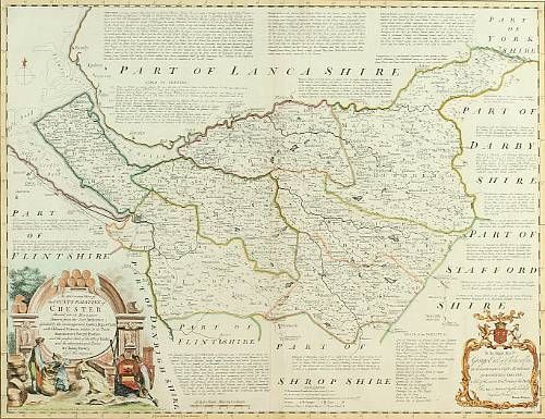
| Map of the County Palatine of Chester | |
| Emanuel Bowen (1714 - 1767) | |
| 411 | |
| Engraving engraved map, hand coloured, with extensive annotations and vignette | |
| Prints & Graphic Art | |
| 53 cm - 68 cm (20.87 in - 26.77 in) | |
| Signedin to unlock | |
| Auction 07/03/2007 | |
| Mar 06, 2007 |
Map of the County Palatine of Chester
411
Engraving engraved map, hand coloured, with extensive annotations and vignette
Prints & Graphic Art
53 cm -
68 cm (20.87 in -
26.77 in)
Mar 06, 2007