- Login
Emanuel Bowen (1714 - 1767)
Item 1 of 1
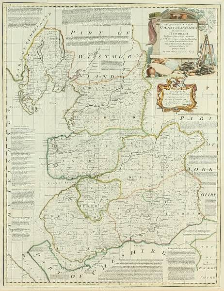
| Map of the County of Lancaster | |
| Emanuel Bowen (1714 - 1767) | |
| 406 | |
| Engraving engraved map, hand coloured, with extensive descriptive text and vignette | |
| Prints & Graphic Art | |
| 69 cm - 52 cm (27.17 in - 20.47 in) | |
| Signedin to unlock | |
| Auction 07/03/2007 | |
| Mar 06, 2007 |
Map of the County of Lancaster
406
Engraving engraved map, hand coloured, with extensive descriptive text and vignette
Prints & Graphic Art
69 cm -
52 cm (27.17 in -
20.47 in)
Mar 06, 2007